We’re at that stage in these trips, where time seems to speed up. It’s always the same, in the first month, the three months streach out with endless future possibility. The second month sees time quicken, opportunity for exploration a little tighter each day, and by the third month, it’s a gnashing of teeth for all the things you’d need weeks to explore, flying past your window.
We’re almost in the third month, over 2,500 kilometres away from the Le Havre ferry back to England, never mind the long drives then to Cornwall and back to London. It’s a daunting thought, how much ground there is left to cover, and how many beautiful places are still left to see.
In this mind set, we compromise our final exploration of the High Coast, the Hoga Kusten, driving through the off highway trails as opposed to doing them the full justice that weeks of hiking would deliver.
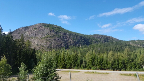 First stop is one of the skullcap mountains, Skulberget, so named for its ancient history of once being the shore line, now nearly 1,000 feet in the air. It holds the world record at 286 metres, the highest land uplift in the world, and the reason it’s been declared a UNESCO World Heritage site.
I’m still having trouble picturing an ice sheet over three kilometres thick, so large that it depressed the Earth’s crust. 10,000 years on, it’s an event from which it’s still recovering at the rate of 1 cm per century.
 There’s an excellent information centre that guides us through each major phase of the archeological change, where the sea level was over each 500 year tranche and the history of flora and fauna over this time. We learn that there is a lake at the mountain top that still is home to Arctic shrimp, a legacy creature from thousands of years ago when the area was part of the sea. From ancient sea bed to present day mountain top – that’s quite a transition.
We also learn that each significant stage of sea level has left its mark – water erosion on the rocks, evidence of mussels and shellfish where they have no business now being. Outside, those with more time are scaling up Skulberget, some rock climbing, others hiking. From the ground they look tiny in comparison. Not sure I’d have the courage to rock climb (.. nope, on checking, that’s a firm no) but I’d love to hike it. Time. Both a gift and an eternal enemy.
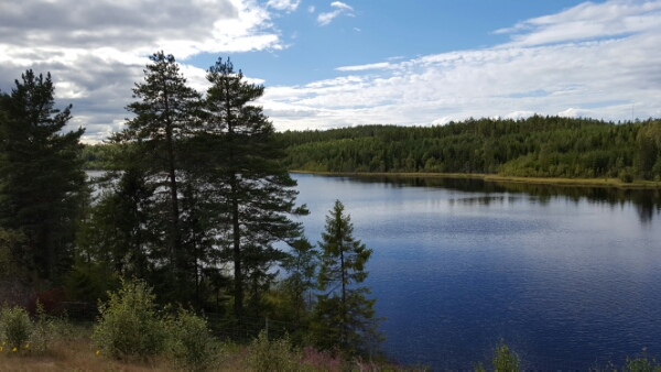
In the meantime, we settle for the High Coast trail, though the villages of Ullanger, Nordingra and Barsta. Most of this area is farmed and a good deal of it has been inhabited since the Stone Age.
 It’s a pretty, unspoilt setting, a lacework of coast weaving around the Gaviksfjarden, Ullangersfjarden and Storsjon waters. In some sections, ancient settlements have been discovered during archeological digs revealing the hunting and living habits of Stone Age man. Seal was on high on the menu, remnants of which are now high on the mountains, again, a place they have no business being.
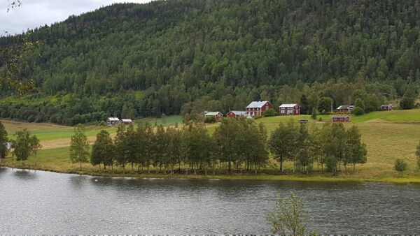 Where it’s not farmland dotted with red cottages, it’s thick forest. Islands, once submerged, now stand alone in the fjord waters. Many are uninhabited, forested right down to the water line, but an occasional house can be seen on some. The village of Nordingra boasts a fine church from 1847 over looking the water, the remnants of a church town to its side.
 We explore best as time allows, the roads are rippled from earth movement and this makes progress a gentle affair. You could spend weeks here, hiking the mountains and exploring every inlet. We’ll only seen a fraction of what’s on offer.
 The late afternoon sees us arrive in Harnosand, the official end of the High Coast. Set on a river, it’s a pretty town with French influences in its architecture. We explore for a while, then cross to a small island, where we spend the night by the harbour.