
What goes up must come down, and it is so as we traverse then descend the mountain, all the while surrounded by the most breathtakingly beautiful scenery imaginable.
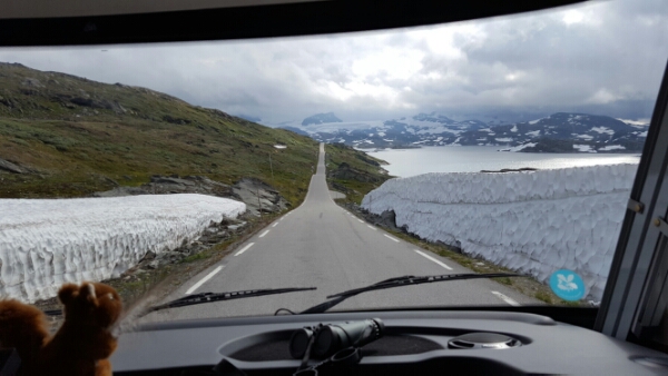
These mountains are much higher than the ones we have been to previously, snow cover is more extensive and ice flows are, in some instances, multi storey buildings high. In one spot, we drive through a drift that flanks the road, taller than we are on both sides.
This side of the road is not as terrifying as yesterday’s. Still a few hairpin turns though. I find out later that this road is known as the Tramps Pass, a previously impassable passage and hide out from those who had a need to be “out of reach by the law” now serviced by the terrifying road we were on yesterday and today…a total of 11 (11!) hairpin turns.
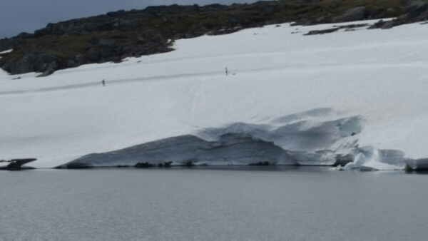
It’s hard to judge size with distance but a resting point gives me great perspective – people cross country skiing on an ice flow at Korpen in a crevasse above lake Fantesteinvatnet. They look like pinpricks atop the ice. It’s massive. A busload of French school kids observe nearby, with that special combination of disdain and disinterest that only teenagers can conjour, one in thongs (flip-flops). Clearly, that parent did not read the school memo in recommended packing.
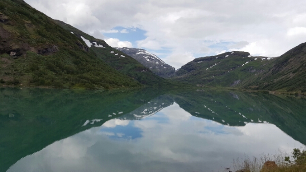
Much of the way is paved by water, ice melt has formed lakes, rivers and endless water falls. The water is at first steel greys then all shades of blues, shifting to oxygenated seafoam green in fast water. We stop at magnificent twin waterfalls, side by side, thundering down the mountain. Despite all the ice, the sun is out, another glorious day.

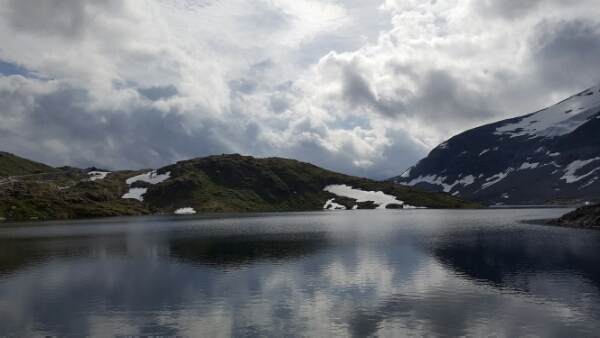
Interpreting the tourist signs is a bit of a challenge, we are literally surrounded by mountains as far as we can see, most around 1500 metres, some over 1600 metres, seriously high. I think we are on Sognetfjellet but it could just as easily be one of many others.
As we descend, Brenheimen National Park unfolds, and the landscape morphs from rock and ice, to brush, to short then tall forests. I’ve learned a new trick – watching the forest shrink and grow and shrink away again in a parody of Alice’s adventures through the looking glass – I can fairly accurately gauge elevation just by looking at the plants around us.
When the mountains have shrunk to hills, we are back to reflecive aqua waters and occasion farms, most in the process of harvesting summer meadows. The sheep are back too, little herds of 4 or 6 ruling the road. In the mountains, I saw a small herd crossing an ice flow, cleverly in single file, something I didn’t think sheep would know to do. Annoyingly, it was as my phone was rebooting, so I failed to get a picture.
Out of the mountains, we’re bound North, up Highway 55. We need to put some miles on the road if we’re to get as far North as we’d like.
